Application Sector
Coastal & Offshore
Forecasting rapidly varying offshore hydrodynamic and atmospheric conditions has become vital to increase safety and productivity at ports, nautical operations and offshore construction, whilst also providing more accurate reporting for coastal and offshore ecosystems. Wind, waves and climate constantly shape our coastline & affect open sea conditions. Real-time monitoring of oceans systems and shorelines is essential to stay in control.
Obscape provides an affordable, easy to use and convenient means to collect and access real-time water and environment data, whether you are monitoring coastal erosion, workability of vessel-based operations, offshore power generation or marine habitats. Our easy-to-deploy, rugged observation equipment is geared towards keeping remote site visits and operational costs to a minimum..
Our innovative equipment paired with the powerful, intuitive Obscape Data Portal creates the perfect tool to obtain observations of baseline behaviour and short-term or long-term changes of the environment, providing a solid base for sustainable management of coastal systems and offshore operations.
Core Products
Integral observation of any coastal & offshore system can be easily achieved by deploying the Obscape WaveBuoy, Weather Station, Level Gauge, Time-Lapse Camera, Wave Gauge, Wave Module, Rain Gauge, or integrating any 3rd party sensor like a Water Quality Sonde or Current Profiling Sonde.
Combined with real-time reporting through to the Obscape Data Portal, Obscape PTM monitoring systems are ideal for coastline & marine water applications including dredging operations, offshore power generation, coastline and marine based construction, aquaculture farming, port and nautical operations, marine and estuarine ecosystems.
Coastal & Offshore
Application Devices
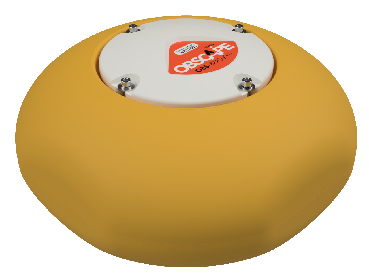
WaveBuoy
Lightweight, tough & reliable wave measurement buoy; which accurately measures full bulk wave & directional wave spectra parameters. Real Time measurements transmitted to the Data Portal through low cost cellular communication.
The Wave Buoy uses a combination of motion sensors and an electronic compass to measure the directional wave field with high accuracy. This yields the directional wave spectrum and all parameters that can be derived from it, such as the 1-dimensional energy-density spectrum and a range of bulk wave parameters (significant wave height, peak wave period, peak wave direction, etc.).
Purchase includes Free use of the Data Portal, for the lifetime of your Wave Buoy, 8 x lithium D Cell batteries ( up to 12 months lifespan) and 100 EUR of free Cellular data- enough Data to last you up to 12 years!
- Incl. data portal, 8 x lithium batteries and Global SIM with 100 EUR Data
- Mooring line sold seperately
Applications
- Marine & Coastal engineering
- Floating Solar Farms
- Oceanographic research
- Environmental monitoring
- Work compliance monitoring
Level Gauge
Water level monitoring plays an important role in monitoring natural or man-made water features. Obscape’s Level Gauge delivers real-time water level measurements. It records the water level using a highly accurate radar sensor. Since the instrument is mounted above the water surface, deploying it in the field is easy.
Applications
The Obscape Level Gauge measures the distance to the water surface using a highly accurate, industry standard radar sensor to monitor tide surges, storm water levels & vessel water ingress. Mount it above water surface in ports, offshore structures & coastal points. The Obscape Level Gauge avoids costly and labour-intensive underwater operations. The incredible 20 metre range of the Level Gauge covers even the most extreme water level variations. The Obscape Level Gauge is suitable for deployment to monitor & observe offshore power generation, coastline and marine based construction, ports and estuarine ecosystems.
Wave Gauge
Non-contact radars offer the highest resolution of sea wave measurements in real-time.
Obscape’s radar Wave Gauge offers a low-cost and user-friendly way to obtain accurate nearshore wave observations
Applications
The Wave Gauge is conveniently mounted above the water surface. It’s millimetre-accurate radar sensor ensures good-quality wave data. Wave observations in a harbour basin, at an offshore platform or at a shore-based pier or jetty have never been so easy. Whether you are interested in improving navigational safety or wish to investigate the impact of waves on coastal morphology, the Obscape Wave Gauge suits your needs in Ports and harbours, Stationary offshore structures, Piers and jetties, Estuaries and lagoons.
The Wave Gauge is powered by 18-36V mains power, while data transmission to the Obscape Data Portal is completely wireless because of the built-in 4G cellular modem. Therefore, the Wave Gauge is easy to install at any desired location within cellular coverage where mains power can be made available.
Time-Lapse Camera and HQ Camera
Obscape’s Time-Lapse Camera and HQ Camera are robust, fully wireless solutions that deliver time-lapse images to your desktop in real-time. They allows you to have a look at your area of interest at any time of the day, wherever you are. Power is supplied through built-in solar panels, while images are transmitted in real-time using a 3G GSM connection. Its wireless nature & optional camouflage pack makes the Obscape Time Lapse Camera sustainable & very suitable for discrete monitoring of remote areas.
Applications
Due to its wireless nature and compact housing, our Time-Lapse Camera is easy to deploy in any environment including mounting on floating sea platforms, marine operations, estuaries, lagoons, coastlines and even offshore buoys.
Obscape Time-Lapse cameras are ideal for dense coverage of spatial and temporal dynamics, allowing you to keep a close watch on everything that happens in your Coastal & Offshore areas of interest including offshore operations, coastline evolution, coastal and marine based construction, ports and nautical infrastructure and estuarine and beach activity.
Rain Gauge
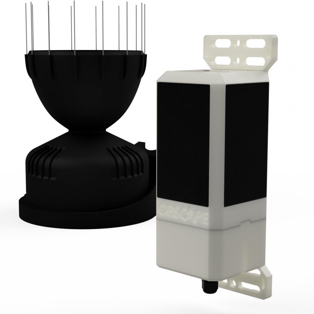
Obscape’s Rain Gauge delivers real-time rainfall measurements. Its industry-standard rain collector is connected to Obscape’s Power and Telemetry Module to create a completely wireless real-time rain gauge. A network of Rain Gauges will yield valuable insights into the dynamics of your water systems.
Applications
Rainfall intensity can vary strongly over time and at different locations along the coastline and offshore. Tropical cyclones, cold fronts & offshore depressions can be forecast by observing the correlation of rain intensity and a weather event offshore. To stay informed of potential disastrous events, a network of rain gauges is an ideal accessory device for any Coastal & Offshore monitoring program. Obscape’s Rain Gauge is also the perfect instrument to provide you with the latest rainfall data at any location along the shoreline area. The Obscape Rain Gauge is robust, wireless & unobtrusive; making it easy to deploy on : beaches, coastal construction sites and offshore power generation sites. s.
Weather Station
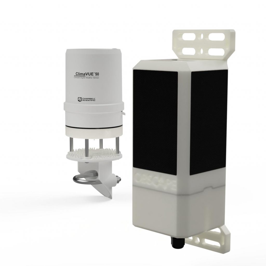
Obscape’s robust and user-friendly Weather Station s combines Obscape’s Power and Telemetry Module with an industry-standard weather sensor. Built-in solar panels and the GSM connection guarantee easy hassle-free installation & monitoring in any environment. The Obscape Weather Station can measure weather events in your location, compare with historical records, or set alarms
Applications
The Obscape Weather Station should be a standard asset of your environmental monitoring setup. It provides a wide range of weather parameters in: beaches, coastal construction sites ,offshore structures and power generation sites. s.
Data Portal
The Obscape Data Portal is one of our core products because of the great value it brings to easily view and analyse observations in real-time. The secure and powerful Obscape Data Portal is web-based and developed by Obscape to support integral monitoring and management of entire water systems.
Intergral Data Management
The Obscape Data Portal does more than just visualising your real-time observation data. It includes tools for data management and analysis, such as a variety of data downloads, flagging invalid data points, comparing data across all your measurement stations, and viewing historic statistics of your dataset. Furthermore, you can register for periodic data reports in PDF format that are delivered to you by email.s.


